Dobro došli
26 May

Takahue old school hall to Ahipara
KM 101
Distance: 16.5km
Elevation: ascent 85m; descent 125m
Steps: 24,000
Time: 8:30am - 2:00pm
The generosity of last night's hosts continued this morning. There was a range of breakfast foods left on the kitchen bench for us to help ourselves to. Someone even offered to cook us some eggs. We declined the eggs. You know when a person is extremely generous but you get to the point where you feel like it's too much, or you feel a little guilty for accepting so much? We reached that point. But not before we took four mandarins for the road. We said our goodbyes, hoping that we will be able to come back one day to return some of the generosity.
We walked out the gate and toward Kataia, the first planned stop for the day.
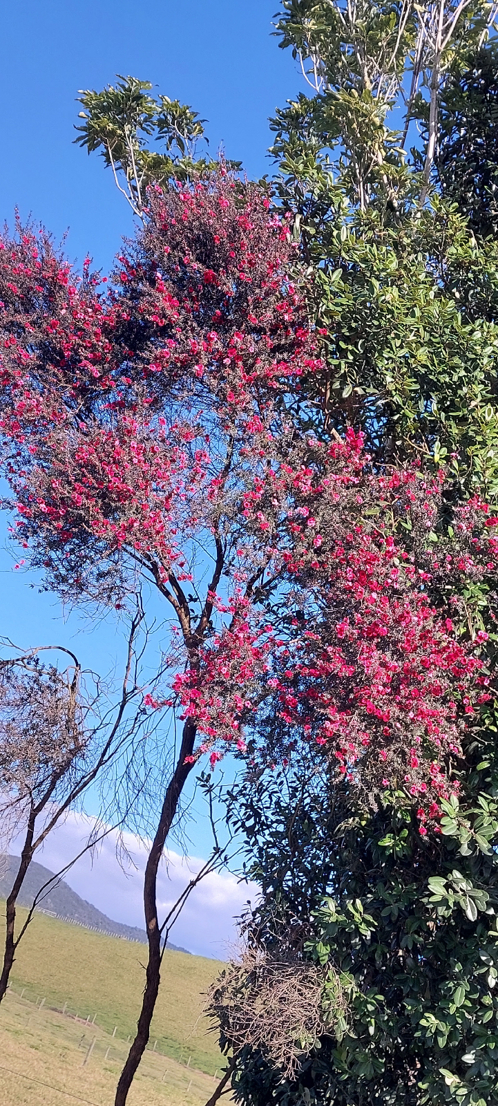
Not many photos today. A long row of (presumably) native trees planted along a property boundary caught our attention.There was a variety of species, including pohutukawa, one of which was in flower. This manuka was also in flower, but with striking pink flowers instead of the white we're used to.
Vaughan continued to make friends with bovines and challenging them, unsuccessfully, to running races. They show interest initially but soon give up.

After walking 11km of country roads we once again encountered our arch nemesis of the north State Highway 1. We decided to heed the advice in the official trail notes and hitchhike the next 6km to Kaitaia. It's never a straightforward choice to hitch because we want to walk as much of the way as possible. But we have the sensibility that comes with age so we put out a thumb and had a lift in 10 minutes.
Kaitaia is the most northerly large town and the last place on our journey with a decent supermarket. We stocked up with four days of food then made a beeline to a proper coffee shop for lunch and a proper cup of coffee. No, we didn't choose this particular coffee shop because there is a donut shop next door, why do you ask? (Do I have any frosting on my face?)
The Far North of New Zealand has a strong Dalmatian influence. In the 19th century people arrived from the region in Europe now found in Croatia. The influence continues and we found this shop sign welcoming people in Te Reo Maori, Croatian and English.

Resupplied and fed we walked a few kilometres to the edge of urban fringe of Kaitaia to once again hitch to the next settlement, Ahipara. Again we deemed the risks of walking on such a busy road were too high. Within 5 minutes we had a lift, the Northland locals really have been generous with picking us up!
Our ride dropped us at the south end of town which meant that we could at least walk along the TA route until we reached our accommodation at Ahipara Holiday Park. We also bumped into Aud and Pol, again!
Tomorrow we walk out of the holiday park and straight onto the trail. Soon after we will take our first steps on the beach which will be the last section of our walk.
We are starting to realise that we are doing some 'lasts' on our adventure now.
- last resupply.
- last proper coffee.
- last holiday park / cabin stay.
But not our last road walk as, technically, Ninety Mile Beach is classified as an official road.


Google maps shows Ahipara Horse Treks. You could probably ride horses to Cape Reinga. Same as riding bikes, right?
ReplyDeleteYou know, everyone walks their own walk on the TA. So yeah, that would be legit. I've actually done a couple of horse treks with that company.
Delete